There are three save options in Interference Mapping.
Save JPG
Press Save/Recall Points/Map then Save JPG. At the Save menu, press Enter. A .jpg file of the current screen will be saved.
The JPG file can be viewed on a PC.
Displaying a Saved JPG File on a PC
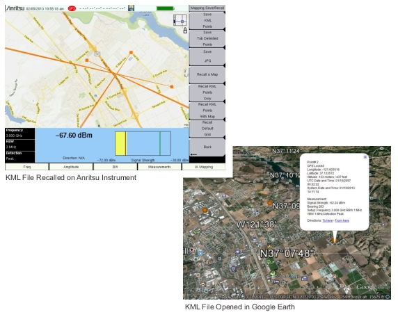
Save KML Points
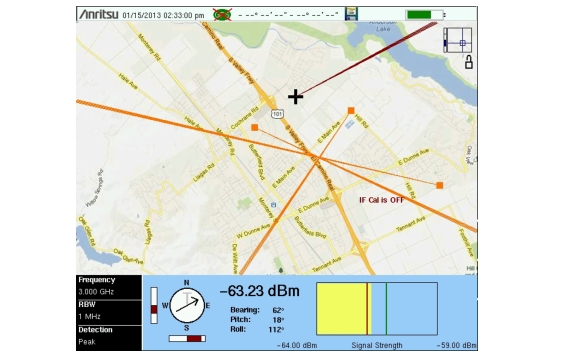
Press Save/Recall Points/Map then Save KML Points. At the Save menu, select KML 2D or KML 3D, then press Enter. The following information is saved for the points and vectors currently displayed on the screen:
To delete existing bearings before recalling a map, refer to Bearing Lines Menu.
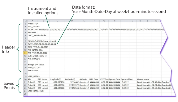
Save Tab Delimited Points
Press Save/Recall Points/Map then Save Tab Delimited Points. At the Save menu, press Enter. A tab delimited text file (.mtd) will be saved to the current location for the points and vectors currently displayed on the screen.
Information for each point includes location, time, signal strength, bearing, and instrument setup data. If you do indoor coverage mapping (or any non-geo-referenced mapping), the .mtd file is saved with the Latitude and Longitude columns in display points (screen display pixels). The upper left corner is 0,0 and the lower right corner is 665, 419. Refer to Coverage Mapping (Option 431) for more information.