Outdoor coverage mapping requires Option 31 (GPS) and a GPS antenna. Indoor coverage mapping utilizes the instrument touch screen to log points, and thus does not require Option 31.
Two screen display options are available for Indoor and Outdoor mapping:
• Map Display Type: Displays an imported map or the default grid. After starting data collection, values for the mapping parameters are recorded for each data point.
Coverage Mapping Using the Map Display
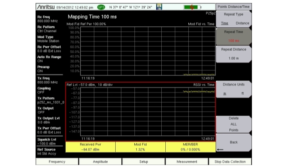
• Graph Display Type: Displays line graphs for 2 of the 3 measurement values for the selected frequency over time. Change the displayed graph type by using the Mapping Type button. Graph points are displayed in yellow when GPS is On and in red when GPS is Off.
The graph display can show the most recent 551 measured points, covering approximately 30 minutes of measurement. The most recent data appears at the right edge of the display. These two measurements with the third measurement type (not displayed in a graph) are shown in three fields with a yellow background at the bottom of the screen.
Coverage Mapping Using the Graph Display
The Coverage Mapping option allows for both indoor (no GPS signal) and outdoor (GPS signal required) mapping.
• Indoor Mapping: Using a start‑walk‑stop approach, the instrument provides in‑building coverage mapping by overlaying data directly onto the downloaded map. Data is captured at user‑defined time intervals or user‑defined map locations by tapping the touchscreen.
• Outdoor Mapping: The instrument logs data automatically based on either time or distance interval. If no map is available when making the measurements, then you can still save all the data to a KML file and later combine the data file with a map. Refer to Recall the Default Grid.
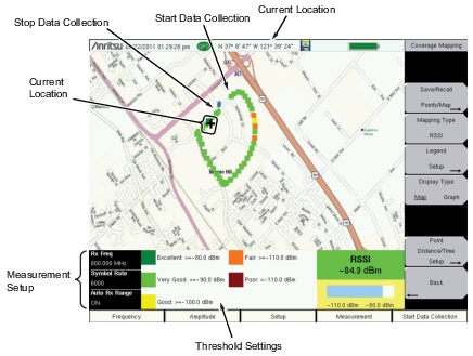
Outdoor Coverage
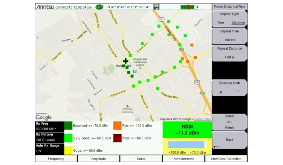
With a valid GPS signal, the instrument identifies the current location on the displayed GeoEmbedded map with a cross. Previously saved locations are displayed as squares.
Outdoor Coverage Mapping (GPS On)
Note
The Measurement Setup and Threshold Setting boxes can be used as menu shortcuts on touch screen instruments. Use the touch screen to select the parameter to edit.
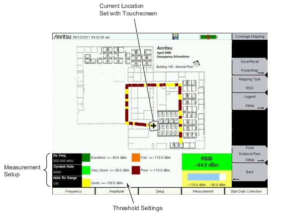
Indoor Coverage
With GPS turned Off, and with a non‑GeoEmbedded map file, you indicate the current position (+) on the displayed map by using the instrument touch screen. Previously saved locations are displayed as squares.